View in high resolution Opens in a new window.
Skip to product information
1 of 7

Black Sea c. 1700–1710

Black Sea c. 1700–1710

Regular price 32 €
Regular price Sale price 32 €
Sale Sold out
Taxes included. Shipping calculated at checkout.
4.9 out of 5 stars from 90 reviews

More than 1,000 customers trust our products

  • Professionelle Aufbereitung von Kontrast & Farben
  • Feinste Druckqualität in hoher Auflösung (>300 DPI)
  • Mattes Papier: Classic 170 g/m² · Museum 250 g/m²
  • Lokale Produktion in mittelständischen Unternehmen
Größe
Papier

Classic: matt, 170 g/m² · Museum: naturweißes Archivpapier, 250 g/m²

Rahmen

Holzrahmen mit Classic · Premiumrahmen mit Museum. Beide Papiere auch ohne Rahmen.

Papier und Rahmen im Detail
Zufriedenheitsgarantie mit 30 Tagen Rückgaberecht und 2 Jahren Gewährleistung
View full details

Über diese Karte

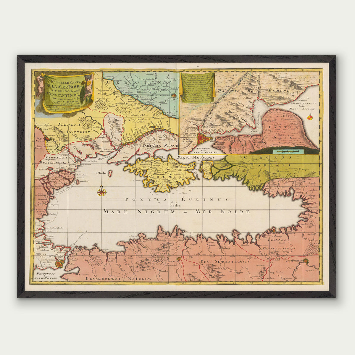
This historical map shows the Black Sea c. 1700–1710 and was produced by Nicolaes Visscher and Peter Schenk. The map shows the sea together with the Bosporus, Crimea, parts of present-day Ukraine and Anatolia. Coastlines, straits and neighbouring lands between Europe and Anatolia appear within a single map image.

As a modern reproduction, this map print brings the early 18th-century image back to you, for instance if you are curious about the history of the Black Sea region.

Historical context

Around 1700 the Black Sea was largely dominated by the Ottoman Empire, which controlled the Bosporus from Istanbul and held the coasts of Anatolia and much of the remaining shoreline. Crimea formed the Crimean Khanate, a vassal state of the Ottomans.

Under the Treaty of Constantinople in 1700, Russia kept the fortress of Azov, captured in 1696, and with it access to the Sea of Azov. In Ukraine, the Cossack Hetmanate was under Russian suzerainty; after the Battle of Poltava in 1709 it was bound more closely to Russia.

  • Subject: Black Sea
  • Date: c. 1700–1710
  • Map type: Historical map
  • Region: Black Sea, Bosporus, Crimea, Ukraine, Anatolia
  • Cartographer / publisher: Nicolaes Visscher, Peter Schenk

Druck & Material

Classic

Mattes, ungestrichenes Papier mit 170 g/m².

Museum

Mattes, naturweißes Archivpapier mit 250 g/m² für eine besonders lange Haltbarkeit.

Holzrahmen

Natur, Dunkelbraun oder Schwarz. Schmale Leiste, 12 mm breit und 22 mm tief, mit Acrylglas – mit Classic-Papier.

Premiumrahmen

Natur oder Schwarz. Breite Holzleiste, 20 mm breit und 20 mm tief, mit Acrylglas – mit Museum-Papier.

Fertig zum Aufhängen

Gerahmte Drucke kommen mit einem Aufhänger auf der Rückseite.

Die verfügbaren Größen und Ausstattungen findest du oben in der Auswahl.

Gut zu wissen

Produktion und Verpackung

Deine Karte wird auf Bestellung gefertigt und stabil für den Versand verpackt.

Lieferung und Versandkosten

Den voraussichtlichen Liefertermin findest du oben beim Produkt. Versandkosten und Lieferbedingungen richten sich nach dem Lieferland.

Versandkosten und Lieferzeiten ansehen

Zufriedenheitsgarantie und Rückgabe

Informationen zu unserer Zufriedenheitsgarantie und zur Rückgabe findest du hier:

Zur Zufriedenheitsgarantie · Rückgabebedingungen

Das sagen Kunden über unsere Produkte